


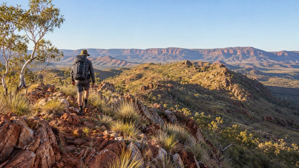
Picture a red rock ridgeline, a headlamp beam bouncing over spinifex, and a summit you want to reach before the sun turns the valley into an oven. That’s a normal morning on Australia’s Larapinta Trail. This Outback walk of roughly 139 miles pays off for hikers who come ready for heat, rock and long gaps between water.
- The Larapinta runs about 139 miles through the Tjoritja/West MacDonnell Ranges, and a full thru-hike takes around two weeks.
- Each section starts and ends at a trailhead water tank, but one stretch in Section 9 goes 19 miles with no reliable water.
- April through August is the best window. Outside it, temperatures can hit 113°F to 122°F.
Where the Trail Takes You
The Larapinta links Alice Springs Telegraph Station with Mount Sonder, which the Aranda people call Rutjupma. Sonder rises to 4,530 feet and is the fourth-tallest mountain in the Northern Territory. Between those two points, the route strings together rocky ridges, red-earth valleys, dry riverbeds, waterholes and narrow gorges.
This is Aranda country, and the Aranda’s spiritual and cultural ties to it go back at least 50,000 years. Many places along the way carry Dreaming Stories. At Serpentine Gorge, the story of the Rainbow Serpent is tied to the site itself. Standley Chasm, also called Angkerle Atwatye, is a sacred women’s site that the Aranda own and run. It’s one of the best spots on the route to learn about the trail’s cultural history and see its plants and animals.
Speaking of animals, keep your eyes open. Eastern brown snakes, one of Australia’s deadliest species, live out here, and huntsman spiders have been known to crawl around tents at night. Watch where you step and check your gear before you pack it.
Desert Doesn’t Mean Easy
The trail is split into 12 official sections, each 6 to 18 miles long. Most rate as moderately hard. Guides who lead groups here say people tend to underestimate it. Big rocks, uneven track and sharp climbs make it far tougher than the word “desert” suggests.
The route breaks down roughly like this:
- Sections 1 and 2 start on flat ground that lulls you into a false sense of ease, then climb into ridge country. From Euro Ridge you can see across the MacDonnell Ranges and back to Alice Springs.
- Sections 3 and 4 reach Standley Chasm, and past it things get brutal. The trail climbs about 2,300 feet along some of the steepest quartzite ridgelines in the range.
- Sections 5 and 6 cross Razorback Ridge, a knife-edge stretch that earns its name. At Hugh Gorge, you may have to wade or swim through pools to reach camp, depending on water levels.
- Section 9 has the steepest grades on the trail, climbing almost 3,000 feet through the sacred Inarlanga Pass.
- Sections 11 and 12 run from the Finke River past Redbank Gorge to the summit ridge of Mount Sonder, the traditional finish. A popular move is timing the final climb for sunrise so you can look back over everything you just walked.
Sections 4 and 5 stand out as the hardest of the bunch, with steep climbs and exposed ridges. Plan extra time and energy for them.
Water and Heat Shape Every Plan
Water decides how most people plan their days out here. Every section starts and ends at a trailhead water tank. There’s also water at Mulga Camp, about 4 miles from Simpsons Gap, and at Rocky Gully, about 9 miles from Hugh Gorge. Streams and natural pools depend on recent weather and aren’t reliable in Central Australia, so don’t count on them.
The big test is the 19-mile dry stretch between Serpentine Chalet Dam and Ormiston Gorge in Section 9. That’s also the section with the steepest climbing, so you’ll be hauling heavy water up the hardest grades.
Timing matters just as much. April through August brings the mildest weather. Outside that window, temperatures can soar to between 113°F and 122°F. Mornings can still feel cold, and one guide’s advice to shivering hikers is simple. Be bold and start cold.
Permits, Food Drops and Guided Trips
You’ll need to pay a few fees in advance through the Northern Territory Parks Booking System. Plan on an NT Parks pass at Aus$60, campground reservations at Aus$10 per person per night, and walking fees of Aus$25 per night, capped at Aus$125 for six or more nights.
Independent hikers don’t have to haul everything themselves. Companies like Larapinta Express and Larapinta Trail Trek Support handle food drops, supplies and rides between trailheads.
Not ready to walk the whole thing? Section hiking works well here. Intrepid Travel, Tasmanian Walking Company and World Expeditions all run guided trips. One recent Intrepid trip covered about 60 miles in five days, using six trailheads to hike six sections as day walks. If you’re building your own day hikes, guides suggest planning around distance and the official trail grades, especially when you link sections together.
Train for the Rock, Plan for the Water
The Larapinta asks a lot. You’ll face quartzite ridgelines, a 19-mile dry stretch and heat that can turn dangerous outside the cooler months. But the payoff is big. You get hidden waterholes, sunrise from Mount Sonder and a landscape tied to a culture with at least 50,000 years of history here. Go between April and August, plan each day around the water tanks, book your passes early and give sections 4, 5 and 9 the respect they deserve. You can carry a full pack for all 139 miles or piece together a handful of sections over a few days. Either way, take your time out there and let the Red Center reveal itself.
