Our Outdoor Lifestyle
How Wheeler County Ranchers Fight Wildfire

When lightning lit up the dry hills of Wheeler County this July, the people who knew the land best were already moving. Ranchers and landowners who have worked these steep valleys for decades are standing shoulder to shoulder with state and federal crews, and that partnership is helping hold the line against one of the largest fires the region has seen in years.

  • The Rowe Creek Complex grew to nearly 150,000 acres after lightning storms swept through Central Oregon.
  • Volunteer Rangeland Fire Protection Associations are guiding outside crews through terrain most maps can’t fully capture.
  • Trust built during a 2024 megafire is paying off now that resources are stretched thin.

A Fire in Country That Has Burned Before

The Rowe Creek Complex started as a cluster of blazes sparked by lightning, and within days it had spread to roughly 149,000 acres near Mitchell. Communities like Fossil and Spray sit in the middle of it all, small towns surrounded by rangeland valleys and steep cliffs of dry grassland. Fossil has only about 250 houses. Carl Campbell, who has lived there since 1952 and fought plenty of fires over the years, calls this one of the biggest he’s seen.

Campbell remembers when Fossil was a busy logging town anchored by the Kinzua company. Back then, when a fire broke out, Kinzua could send a crew of 100 people to knock it down. The company closed in 1978, and much of the town’s population and firefighting muscle left with it. What stayed behind was something harder to replace: people who understand every draw, road, and grass patch in the county.

Neighbors Who Know the Terrain

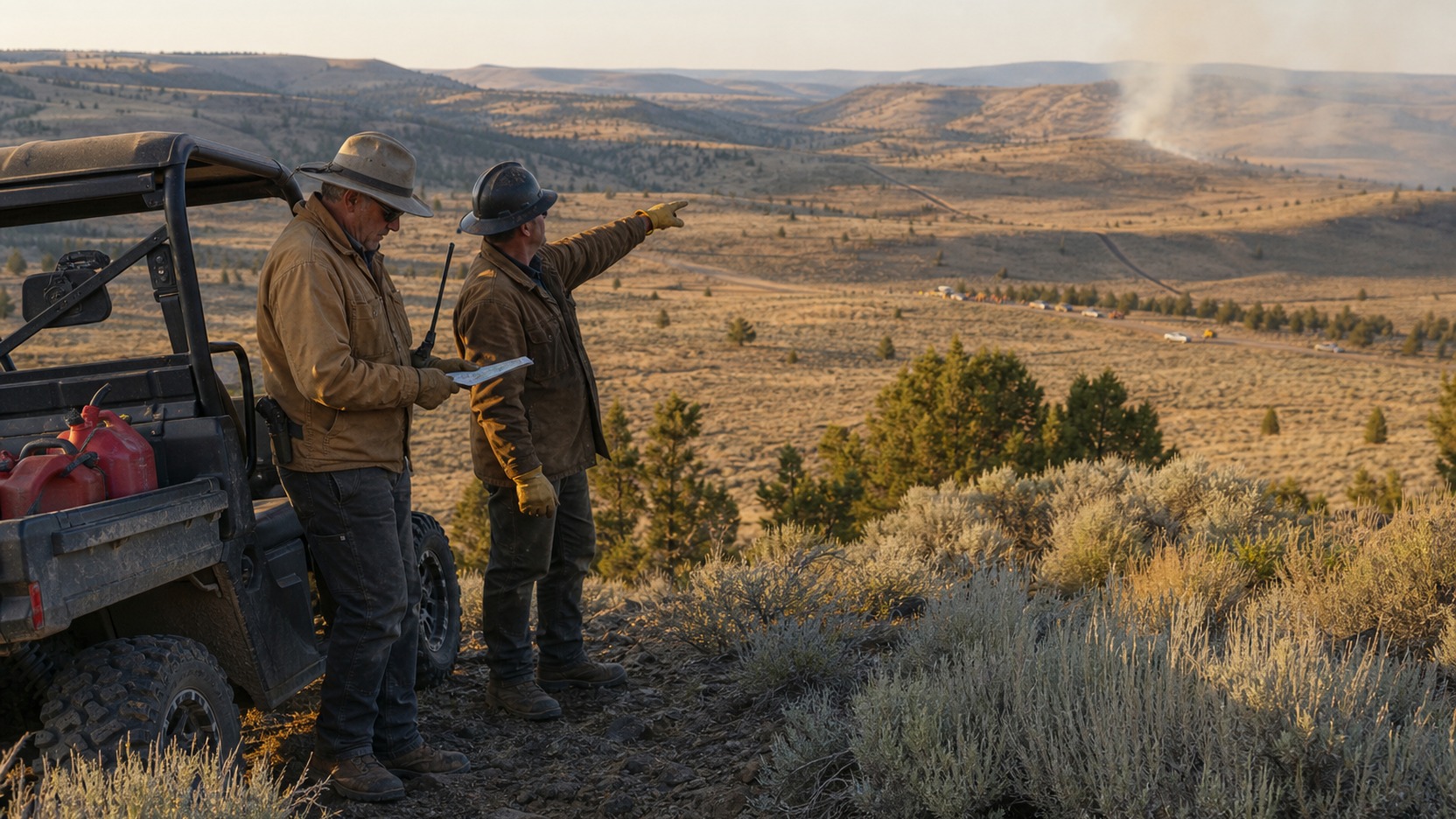
That knowledge now runs through the local Rangeland Fire Protection Associations, or RFPAs. These are volunteer groups of ranchers and landowners who work to protect private property and open rangeland from fire. Terry Harris, a rancher who lives near Spray and volunteers with the Wheeler County RFPA, has spent recent days doing whatever the moment calls for, from running shovels and hoses to directing traffic and pointing crews toward the spots that matter most.

Harris and his neighbors have been working alongside the Oregon Department of Forestry and firefighters from several state and federal agencies. When the big teams roll in, the locals meet them, join up, and show them how to get equipment where it needs to go. Ranch work already leans on rugged gear, and the same machines that move hay and check cattle earn their keep during fire season. A Kubota side-by-side diesel or a beat-up flatbed can haul water and tools down a two-track that no engine could reach, which is exactly the kind of edge a landowner brings to a fight like this.

A Partnership That Took Time to Build

This teamwork wasn’t always smooth. In July 2024, the Lone Rock Fire burned nearly 135,000 acres across Gilliam, Wheeler, and Morrow counties, and more than 1,000 firefighters answered the call. John Szulc, an incident commander with Northwest Team 2 who also worked the Lone Rock Fire, describes the early days of any big response as a kind of awkward dance. Different agencies bring different training, equipment, and habits, and it takes time for everyone to click, sometimes while the fire is still spreading.

Two years later, both sides say the relationship has come a long way. Harris puts it plainly: the local folks have realized they can’t handle these fires alone, and the state has learned that ranchers will do whatever it takes to protect their ground. Everyone has limits, and admitting that is what makes the whole thing work.

Bracing for What Comes Next

The circumstances stay tough. Damon Simmons, a line safety officer with the Oregon State Fire Marshal, says crews are constantly shifting people and equipment from one fire to the next as they weigh where the need is greatest. The Rowe Creek Complex has already reached sensitive ground, including much of the 34,000-acre Pine Creek Conservation Area southwest of Fossil, which the Confederated Tribes of Warm Springs manage for fish and wildlife habitat. Project lead Kevin Pullen expects a long restoration effort, though he notes that fire is a natural process that has simply grown more frequent as the climate turns warmer and drier earlier in the year.

With more dry thunderstorms and lightning in the forecast, Wheeler County is getting ready for another round. The lesson taking hold across these hills is a simple one. When money and manpower run short, the deepest resource a community has is its own understanding of the land, and the willingness of neighbors to share it. Ranchers here plan to keep showing up, fire after fire, because they know the country and they know it needs them.
Why You Should Check Park Conditions Before You Go

What the Babylon Fire Closure Teaches Every Park Visitor

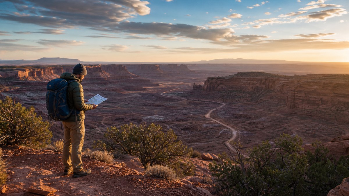
One day you’re planning a quiet hike through red rock spires, and the next a wildfire forces an entire district of a national park to clear out. That’s exactly what happened at Canyonlands when the Babylon Fire pushed north and shut down The Needles with almost no warning.

  • The Babylon Fire near Blanding, Utah closed Canyonlands’ Needles District on June 28, 2026, with immediate evacuations.
  • Southern Utah is having a rough early wildfire season, and fire restrictions have tightened across nearby parks.
  • A two-minute conditions check before you leave can save your trip and keep you safe.

What Happened at The Needles

On June 28, 2026, Canyonlands National Park closed The Needles district until further notice. The cause was the Babylon Fire, which started near Blanding, Utah, inside Bears Ears National Monument. The fire wasn’t burning inside Canyonlands itself, but it was moving north toward the park and UT 211, the main road into The Needles. That progression was enough for officials to act fast.

Everyone in the district had to evacuate right away. The Needles Visitor Center shut its doors. Rangers stopped issuing new backcountry overnight and day use permits, and they paused reservations for The Needles Campground. Day hiking and scenic driving were off the table too. If you had a trip planned that week, it vanished overnight through no fault of your own.

For anyone tracking the situation, the Babylon Fire’s InciWeb page became the go-to spot for incident updates. That kind of official, real-time source matters when conditions shift by the hour.

A Tough Start to Wildfire Season

The closure did not come out of nowhere. Southern Utah landed under an unusually severe wildfire warning in late June, and the Babylon Fire was just one of several burning across the state. The Cottonwood Fire in southwestern Utah was growing fast around the same time. Forecasters were describing it as a furious start to the season, and it was not even July yet.

Land managers responded by tightening the rules. Fire restrictions increased at Arches, Canyonlands, Hovenweep, and Natural Bridges, changing what’s allowed with campfires and other fire-related activities. When the ground is that dry and the wind picks up, a single spark carries real consequences. Those restrictions are the reason a fun campfire can turn into a citation, or worse.

How to Check Conditions Before You Go

Now for the practical part. Most park closures and hazards show up online before you ever pack the car, so a quick habit goes a long way. Build this into your trip planning and you’ll rarely get blindsided.

Start with the park’s own website. Canyonlands keeps an Alerts and Conditions page that lists active warnings, and a separate Road Conditions page that covers backcountry travel and weather effects on unpaved routes. Rain and snow can turn a dirt road into a four-wheel-drive slog or close it entirely, so checking road status the morning you leave is smart, not paranoid.

For fire specifically, InciWeb tracks active incidents with maps and updates. If there’s smoke anywhere near your destination, that’s where you’ll find the real story. Call the district visitor center too. Phone lines are still one of the fastest ways to get current information straight from a ranger, especially for backcountry trips where conditions change quickly.

A few simple checks cover almost everything:

  • Read the park’s alerts and road conditions pages the day before and the day of your trip.
  • Search for any active fires near your route and check current restrictions.
  • Confirm your permits and campground reservations are still valid.
  • Have a backup plan in case a district closes while you’re already on the road.

Plan Smart, Stay Flexible

Closures like the one at The Needles are frustrating, but they’re also a reminder that public lands answer to weather and fire, not to our schedules. The visitors who handle these moments best are the ones who checked the latest updates and kept a flexible mindset. You can’t control a wildfire, yet you can control how prepared you are when one shows up near your route. Spend a couple of minutes on the official sources before every trip, keep an alternate destination in your back pocket, and you’ll spend far less time stranded at a closed gate and a lot more time on the trail.

Grand Canyon Heat Deaths Spark Midday Hiking Warning

Why Grand Canyon Rangers Want You Off the Trails by Midmorning

The Grand Canyon looks calm from the rim, but the heat trapped deep inside its walls can turn a routine hike into a life-or-death situation in a matter of hours. Three people learned that the hard way this June, and park rangers are now pleading with summer visitors to rethink when they lace up their boots.

  • Three hikers died in two separate heat-related incidents along Inner Canyon trails in mid-June.
  • Midday temperatures in the shade can climb past 109 F deep inside the canyon.
  • The Park Service is urging visitors to stay off Inner Canyon trails between 10 a.m. and 4 p.m.

What Happened Inside the Canyon

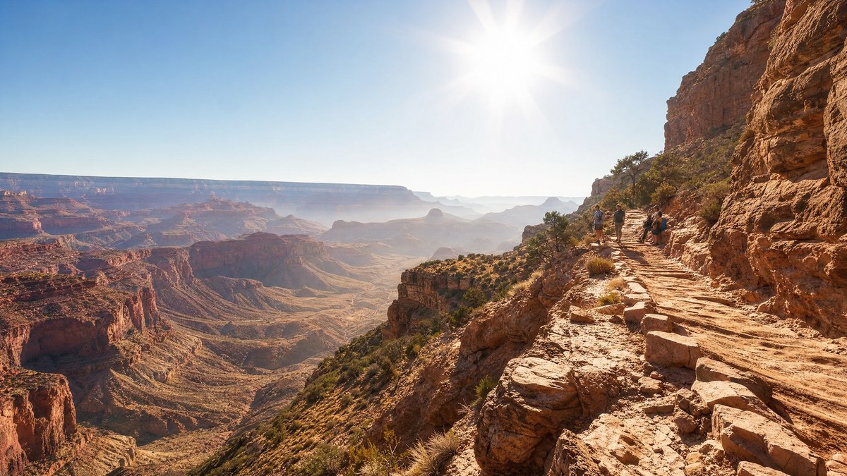
Over a span of just a few days, emergency crews at Grand Canyon National Park answered two heartbreaking calls. Three hikers died from apparent heat-related illnesses on two separate days, both incidents playing out on trails deep in the Inner Canyon, where conditions get brutal once the sun is high.

The first loss came on June 12, when a 72-year-old man fell ill along the South Kaibab Trail. Four days later, on June 16, a 67-year-old man and a 68-year-old woman appear to have suffered the same fate on the North Kaibab Trail. In every case, the outcome was the same. All three had died by the time emergency services arrived. Investigators are still working to confirm the exact causes, and all three were taken to the Coconino County Medical Examiner’s office.

What makes these cases especially sobering is the speed of the park’s response. Rangers moved fast and brought in aerial support, yet none of it was enough. The heat had already done its damage before help could reach them.

How Hot It Really Gets Down There

People often underestimate the canyon because the rim feels pleasant. Drop a few thousand feet, though, and you enter a different world. The rock walls soak up sunlight and radiate it back, turning the lower trails into a natural oven.

During the hottest stretch of the day, temperatures in the Inner Canyon can top 109 F even in the shade. Out in direct sun, on exposed switchbacks with no breeze, it feels far worse. Heat illness sneaks up quickly in those conditions, and the climb back out, all uphill, is exactly when an exhausted hiker is most vulnerable.

The Warning Rangers Are Repeating

The message from the park is simple and direct. Skip the Inner Canyon trails during the peak heat window. After these recent deaths, the National Park Service put out a warning about hiking at midday in the park’s Inner Gorge because of the high temperatures. Officials are asking visitors to stay off those trails from 10 a.m. to 4 p.m.

And the danger isn’t easing up. Visitors are being warned about extreme heat early next week, and the broader region has been baking too. By some local counts, at least four people have died this month while hiking trails at the Grand Canyon as intense June heat grips Arizona.

Smart Habits That Keep You Alive

If you’re set on hiking the canyon this summer, timing is everything. Start before sunrise, turn around early, and treat the heat as the serious threat it is. Carry more water than you think you need, pack salty snacks to replace what you sweat out, and rest in shade whenever you find it.

Pay attention to your body. Dizziness, nausea, a pounding headache, or a strange chill in the heat are all red flags. The golden rule still holds true here. Going down into the canyon is optional, but coming back up is mandatory, and the climb out is the hardest part. Know your limits before you commit to the descent, and never count on being rescued in time.

Plan Around the Heat, Not Through It

The Grand Canyon rewards careful hikers and punishes careless ones. These recent deaths are a reminder that summer in the Inner Canyon leaves almost no room for error. Hike early, get out before the worst heat arrives, and save the midday hours for the shade and a cold drink. The trail will still be there tomorrow, and so should you.

Source URLs: