Our Outdoor Lifestyle
How Wheeler County Ranchers Fight Wildfire

When lightning lit up the dry hills of Wheeler County this July, the people who knew the land best were already moving. Ranchers and landowners who have worked these steep valleys for decades are standing shoulder to shoulder with state and federal crews, and that partnership is helping hold the line against one of the largest fires the region has seen in years.

  • The Rowe Creek Complex grew to nearly 150,000 acres after lightning storms swept through Central Oregon.
  • Volunteer Rangeland Fire Protection Associations are guiding outside crews through terrain most maps can’t fully capture.
  • Trust built during a 2024 megafire is paying off now that resources are stretched thin.

A Fire in Country That Has Burned Before

The Rowe Creek Complex started as a cluster of blazes sparked by lightning, and within days it had spread to roughly 149,000 acres near Mitchell. Communities like Fossil and Spray sit in the middle of it all, small towns surrounded by rangeland valleys and steep cliffs of dry grassland. Fossil has only about 250 houses. Carl Campbell, who has lived there since 1952 and fought plenty of fires over the years, calls this one of the biggest he’s seen.

Campbell remembers when Fossil was a busy logging town anchored by the Kinzua company. Back then, when a fire broke out, Kinzua could send a crew of 100 people to knock it down. The company closed in 1978, and much of the town’s population and firefighting muscle left with it. What stayed behind was something harder to replace: people who understand every draw, road, and grass patch in the county.

Neighbors Who Know the Terrain

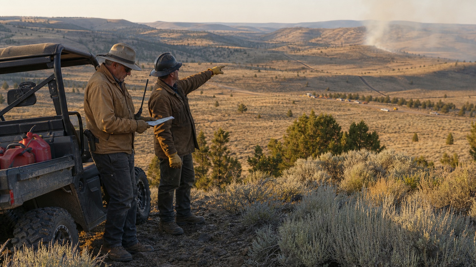
That knowledge now runs through the local Rangeland Fire Protection Associations, or RFPAs. These are volunteer groups of ranchers and landowners who work to protect private property and open rangeland from fire. Terry Harris, a rancher who lives near Spray and volunteers with the Wheeler County RFPA, has spent recent days doing whatever the moment calls for, from running shovels and hoses to directing traffic and pointing crews toward the spots that matter most.

Harris and his neighbors have been working alongside the Oregon Department of Forestry and firefighters from several state and federal agencies. When the big teams roll in, the locals meet them, join up, and show them how to get equipment where it needs to go. Ranch work already leans on rugged gear, and the same machines that move hay and check cattle earn their keep during fire season. A Kubota side-by-side diesel or a beat-up flatbed can haul water and tools down a two-track that no engine could reach, which is exactly the kind of edge a landowner brings to a fight like this.

A Partnership That Took Time to Build

This teamwork wasn’t always smooth. In July 2024, the Lone Rock Fire burned nearly 135,000 acres across Gilliam, Wheeler, and Morrow counties, and more than 1,000 firefighters answered the call. John Szulc, an incident commander with Northwest Team 2 who also worked the Lone Rock Fire, describes the early days of any big response as a kind of awkward dance. Different agencies bring different training, equipment, and habits, and it takes time for everyone to click, sometimes while the fire is still spreading.

Two years later, both sides say the relationship has come a long way. Harris puts it plainly: the local folks have realized they can’t handle these fires alone, and the state has learned that ranchers will do whatever it takes to protect their ground. Everyone has limits, and admitting that is what makes the whole thing work.

Bracing for What Comes Next

The circumstances stay tough. Damon Simmons, a line safety officer with the Oregon State Fire Marshal, says crews are constantly shifting people and equipment from one fire to the next as they weigh where the need is greatest. The Rowe Creek Complex has already reached sensitive ground, including much of the 34,000-acre Pine Creek Conservation Area southwest of Fossil, which the Confederated Tribes of Warm Springs manage for fish and wildlife habitat. Project lead Kevin Pullen expects a long restoration effort, though he notes that fire is a natural process that has simply grown more frequent as the climate turns warmer and drier earlier in the year.

With more dry thunderstorms and lightning in the forecast, Wheeler County is getting ready for another round. The lesson taking hold across these hills is a simple one. When money and manpower run short, the deepest resource a community has is its own understanding of the land, and the willingness of neighbors to share it. Ranchers here plan to keep showing up, fire after fire, because they know the country and they know it needs them.
The Grand Canyon Water Fight That Should Make Every Backpacker Rethink Their Filter

A quiet regulatory vote in Arizona has put one of the most photographed water sources in the country under a new kind of scrutiny, and the ripple effects reach far past the canyon rim. If you drink from wild water anywhere, this story is worth your attention.

  • Arizona raised the allowable arsenic level in a monitoring well near the Grand Canyon from 50 to 55 micrograms per liter.
  • The EPA drinking water standard for arsenic is just 10 micrograms per liter because of cancer risk.
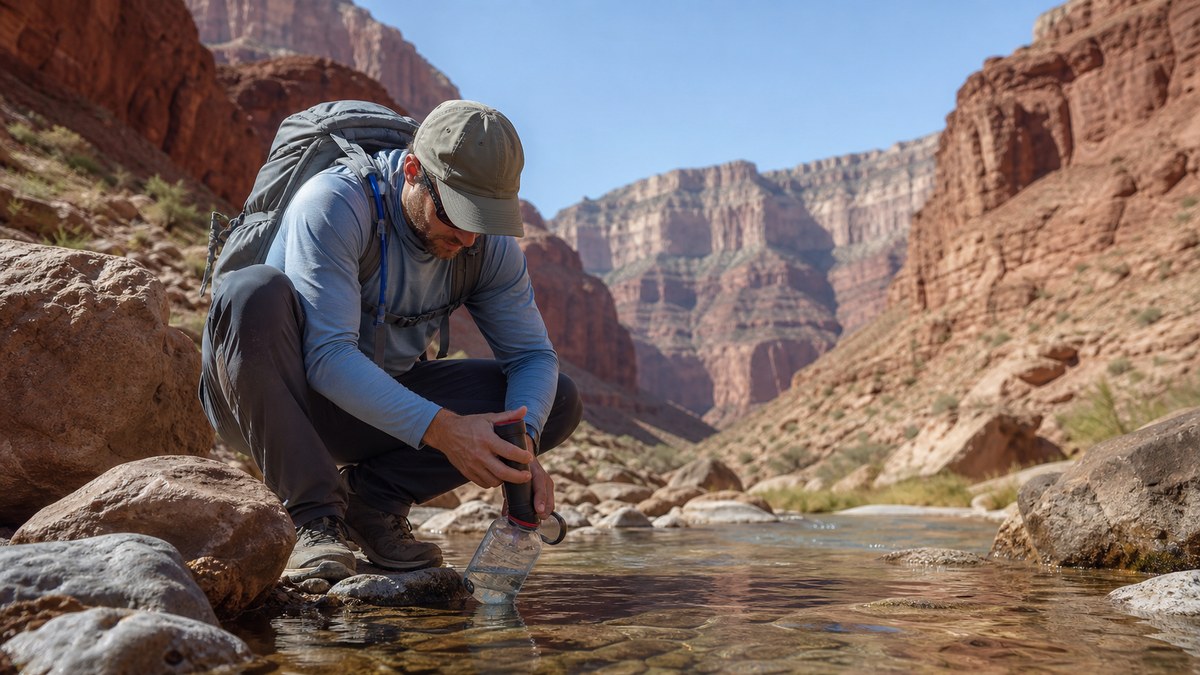
  • Standard backpacking filters catch bacteria but do nothing to remove dissolved heavy metals like arsenic.

What Actually Happened Near the Canyon

On July 6, 2026, the Arizona Department of Environmental Quality voted to let the Pinyon Plain uranium mine raise the acceptable arsenic level in one of its monitoring wells. The number moved from 50 to 55 micrograms per liter. That may sound small, but the original ceiling was already five times the federal drinking water limit. The EPA caps arsenic in drinking water at 10 micrograms per liter, and for good reason. Long exposure has been linked to bladder, lung, skin, kidney, liver, and prostate cancers.

The Pinyon Plain Mine sits about seven miles south of Grand Canyon National Park. It was built in the eighties, covers 17 acres, and runs nearly 1,500 feet deep. The bigger concern is what lies beneath it. The mine sits on top of the Redwall-Muav aquifer, the sole water source for the Havasupai people and the origin of Havasu Creek. That creek feeds the famous turquoise waterfalls that draw as many as 40,000 visitors a year.

Why the Numbers Have People Worried

Monitoring wells work like early warning systems. Amber Reimondo, energy director for the Grand Canyon Trust, described them as the canaries in the coal mine. Arsenic increases first showed up in January 2025, and the well exceeded its permitted alert level four separate times. Critics argue that when alarms keep going off, the right response is a hard look at the cause, not raising the threshold so the alarms stop ringing.

State regulators see it differently. An ADEQ spokesperson said more than four and a half years of site data show the mine is not adding arsenic to the groundwater. Instead, they say the mineshaft creates a hydraulic sink that pulls naturally occurring arsenic from the surrounding rock toward the wells. Adjusting the limit, in their view, reflects that geological reality rather than new pollution.

Scientists remain cautious because the hydrology here is genuinely hard to map. Recent research using dye tracers showed water traveling long distances between the shallow Coconino aquifer and the deeper Redwall-Muav system, proving the two are connected in more places than once assumed. Water that gets contaminated at one point can move both sideways and down, which makes it tough to predict where trouble ends up. Federal reviews by the U.S. Geological Survey and the EPA concluded that more study is needed before anyone can say the site is safe.

The Lesson for Anyone Who Drinks Wild Water

Here is the part that matters whether you live near the canyon or thousands of miles away. Most hikers trust a pump or squeeze filter to make backcountry water safe. Those filters handle bacteria and protozoa well. They do almost nothing against dissolved heavy metals like arsenic, lead, or uranium. You can filter a liter until it looks crystal clear and still be drinking something that hurts you over time.

This is not only a Southwest issue. Old mining districts, industrial sites, and even natural rock formations can leach metals into streams across the country. Backpackers heading out from places like Muncie, IN often assume clean-looking water is safe water, and that assumption travels with them to bigger trips out West. The habit of checking the ground you walk over, not just the water in front of you, is a good one to build anywhere.

Simple Habits That Keep You Safer on the Trail

You do not need a chemistry degree to travel smarter. Learn the mining and industrial history of the areas you visit, since land agencies and local advocacy groups often publish water quality notes. When metals are a known risk, reverse osmosis or specialized filtration is the only reliable answer, and carrying enough water in from a trusted source often beats gambling on a questionable spring. Pay attention to signage, and treat posted warnings as real rather than bureaucratic noise.

The canyon fight is still unfolding, and the Havasupai and several conservation groups continue to push back. For the rest of us, the takeaway is quieter but useful. Water that looks pure can carry things no ordinary filter removes, so a little research before a trip protects you long after you have packed up and gone home.

Why Climbers Are Walking From the Ocean to Everest This Spring

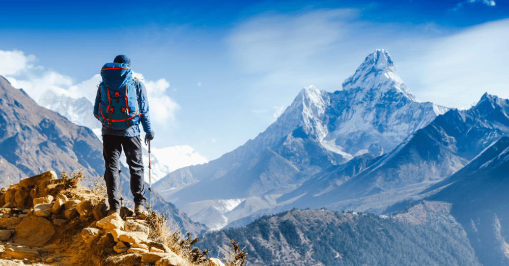
Most people who climb Everest fly into Kathmandu, hop a small plane to Lukla, and trek about ten days to Base Camp. But this spring, a growing number of climbers are taking a wildly different approach. They’re starting thousands of kilometers away, at the edge of the ocean, and making their way to the summit using nothing but their own legs and lungs. The Everest sea to summit trend is picking up real momentum in 2026, and the stories behind it are as wild as the mountain itself.

Read More

Night-Sky Road Trips That Make Autumn Feel Bigger

Pull off at the right scenic overlook on a cool October evening and you’ll understand why autumn is when the stars feel closest. The air gets crisp, humidity drops away, and those early sunsets give you hours to watch the sky wake up. Pack a thermos, grab a blanket, and head out to where the Milky Way actually looks like a river of light.

  • Autumn offers the clearest skies for stargazing, with lower humidity and stable air that reduce atmospheric distortion.
  • Dark-sky parks across the Southwest provide the best viewing conditions, with Utah alone hosting more than two dozen certified locations.
  • Night driving needs specific safety prep including clean headlights, regular breaks, and dimmed interior lighting.

Why Fall Wins for Sky Watching

You’ve probably noticed how different the air feels once September rolls around. That crispness makes for better stargazing. Summer brings warm nights but thick humidity that blurs the view. When temperatures drop in autumn, the atmosphere stabilizes and less water vapor means clearer sightlines straight up through space.

Sunset hits earlier, so by 8 PM you’re already in full darkness. That gives you solid hours before midnight to spot planets and trace constellations.

Where the Dark Sky Gets Dark

Light pollution from cities washes out the night sky for miles around. That’s where designated dark-sky parks come in. These spots are certified by DarkSky International for having genuinely low light pollution.

Utah dominates with more certified locations than any other state. Arches and Canyonlands National Parks both offer ranger-led night programs during fall. Big Bend National Park in Texas sits so far from major cities that it claims some of the darkest skies in the lower 48 states. Cherry Springs State Park in Pennsylvania brings dark skies to the East Coast, rare for that heavily populated region.

Planning Your Route

Pick a destination but keep your route flexible. Weather can shut down a perfect stargazing spot fast. Check moon phases before you go. Four days before or after a new moon gives you the darkest conditions.

Highway routes work better than back roads for night driving. Route 163 through Monument Valley offers stunning pullouts. Utah’s Highway 12 connects multiple dark-sky parks through red rock country.

Gear You Actually Need

Start with good binoculars. Look for 7×50 or 10×50 models. Bigger front lenses gather more light when you’re trying to see dim objects billions of miles away.

Get a red flashlight. Your eyes need about 20 minutes to adjust to darkness. Regular white light ruins that instantly. Red light lets you read star charts without resetting your night vision.

Dress warmer than you think you need to. Nights in the desert can drop to 40 degrees. Bring layers and download a planetarium app like Stellarium Mobile before you lose cell service.

Staying Safe After Dark

Night driving requires different habits than daytime cruising. Your reaction time drops when you can’t see as far ahead. Slow down on unfamiliar roads. Use your high beams on empty highways but dim them when you see oncoming traffic.

Get your windshield and headlights clean before you leave. Dirty glass scatters light and creates glare. What looks barely noticeable in daylight becomes actively dangerous at night.

Dim your dashboard lights. If the gauges are blazing at full power, looking from the dash to the dark road ahead disorients your eyes. Some vehicles with blackout styling help here. The Camaro Black Panther edition features low-glare interior lighting that works well for nighttime adventures, keeping the cabin dark enough to preserve your night vision while still seeing the controls.

Take breaks every two hours minimum. Pull over, walk around, stretch your legs. Fatigue hits harder at night. Keep an emergency kit in your trunk with flashlight, jumper cables, first aid supplies, water, and snacks.

Making the Most of Your Stop

When you find a good pull-off, give your eyes time to adjust. Spend the first 15 or 20 minutes just sitting in the dark. It feels like nothing is happening, then suddenly you notice stars you couldn’t see before. The Milky Way develops detail instead of looking like vague haze.

Look away from direct lights. If a car drives past, turn your head so the headlights don’t hit your eyes straight on. Learn a few easy constellations before your trip. Orion is up by late autumn, impossible to miss with its belt of three bright stars in a row.

Your Next Clear Night

Autumn stargazing turns a regular road trip into something that sticks with you. You don’t need expensive equipment. Just drive away from the city lights, find a dark spot, and look up.

Check the weather forecast a day ahead. Clear skies matter more than anything else. Plan for at least three hours at your stargazing spot. This isn’t about checking boxes. It’s about sitting under a sky so full of stars you can’t count them all.

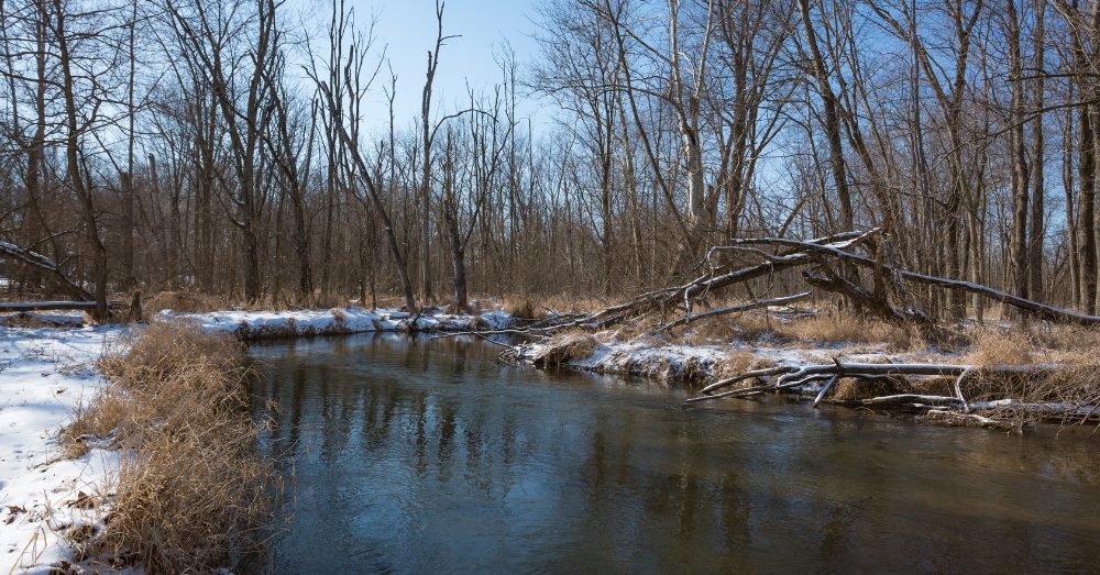
Winter River Walks: Indiana’s Hidden Cold-Weather Beauty

Most people store their kayaks and wait for spring, but they’re missing something good. Indiana’s rivers change completely when temperatures drop, offering peaceful walks, clear views, and wildlife you won’t see during warmer months. The White River winds through charming towns where winter brings a quieter kind of magic to the water’s edge. Read More